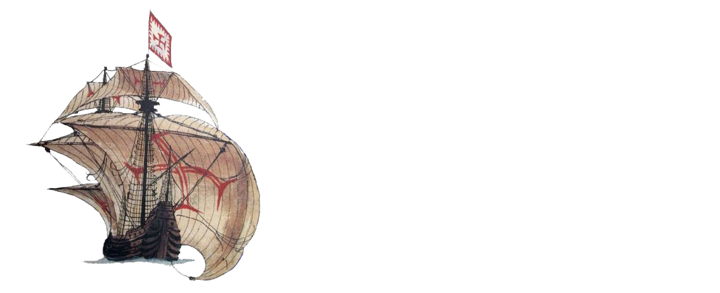
Mercante de Manzanillo, 1741
Jesús Alberto Aldana Mendoza
Country: Colombia
Place: Canal de Manzanillo, Cartagena de Indias
Coordinates (approximate): Lat. ; Long.
Type: Merchant ship
Identified: No
Dated: 1741
Introduction
The 1741 siege by the English Crown of the Spanish colonized Cartagena de Indias brought a great deal of destruction to both sides. The English fleet, led by Edward Vernon, was defeated after two months of battle and lost many of its ships, killing hundreds of its troops. The Spanish defense, commanded by Sebastian de Eslava and Blas de Lezo, was victorious despite its reduced number of soldiers and ships, although much of the city’s defensive system was almost completely destroyed. Many of the forts and batteries that guarded the bay and the access channels were destroyed and, in the same way, the entire backbone of the fleet that defended the city was shipwrecked in the attempt to avoid the English advance. Likewise, in many documentary sources there is a record that not only did the six Ships of the Line that defended the channels of Bocachica and Manzanillo (África, San Carlos, San Felipe, Galicia, Conquistador and Dragón) sink, but also a series of smaller ships were shipwrecked (some of them intentionally drilled) to prevent the English from accessing the inner bay of the city. This is the case of a group of merchant ships that were sunk as a defensive tactic of the Spanish in the Canal de Manzanillo. In this area, a series of archaeological correlates were recorded, linked to one or possibly several shipwrecks that, from the moment they were deposited on the seabed, have been exposed to a great number of transformations that have produced serious effects on the remains that are still preserved in a dispersed manner. It is for this reason, and because of the imminent risk to which the wrecks would be exposed by the dredging of the canal, that it was decided to relocate them to an area where they would be preserved in situ. In this way, the integrity of the elements was guaranteed and they would be sheltered in a safe area, even if the transport tasks were complex and would last several weeks.
Team
The research and technical work carried out for several weeks in the Canal de Manzanillo had the support of several national and governmental institutions, including the Instituto Colombiano de Antropología e Historia (ICANH), the Dirección General Marítima (DIMAR), the Departamento de Buceo y Salvamento (DEBUSA) and the Fundación Terrafirme. With respect to the work team, researchers from Argentina (Cristian Murray, Amaru Argüeso, Damian Vainstub), Uruguay (Alejo Cordero, Valerio Buffa), Mexico (Octavio Del Rio), Spain (Carla Riera) and Colombia (Carlos Del Cairo, Ricardo Borrero, Lorena Palacio, Marcela Manrique) contributed to the successful process of intervention and relocation of the archaeological elements of the shipwreck.
Story of the Ship
In spite of the archaeological work carried out in the context where several remains of a ship were found, the identity of the ship is still unknown due to the absence of data and the probability that it is any of the more than 5 ships that the Spanish defense swept in the vicinity of the Canal de Manzanillo. According to historical approaches it is known that these merchant ships were: San Francisco de Paula, Nuestra Señora de la Concepción, San Miguel and San Cayetano, San Francisco Xavier and Nuestra Señora del Rosario, Nuestra Señora de los Dolores, and San Jorge. The information obtained regarding this small fleet indicates that these ships were in Cadiz at the beginning of 1737, but that they had to be mobilized to Cartagena de Indias later. Exactly four years later, with the English siege, they were shipwrecked together in the areas surrounding the navigation channel. This is well documented in historical and cartographic sources, although none of them show the precise location of each of the ships, hence the impossibility of recognizing which merchant ship the remains located in the area of study belong to.
Representation in historical cartography of the shipwreck (Chaussereau, 1741)
Loss
The immensity of the English fleet, together with their rapid advance, meant that the Spaniards had to resort to a series of defensive tactics where the last resort was to sweep the few boats guarding the bay to prevent the English ships from passing through the approaches to Bocachica and Manzanillo. This procedure was applied not only to the liners that made up the main axes of defense, but also to the small merchant fleet that protected the inner bay. However, despite the sinking of the ships, this tactic only delayed the English for a short time as their fleet was able to gain access to the city despite the desperate attempts of the Spanish defense. The merchant ships, like the rest of the Iberian fleet, were shipwrecked near of the Canal de Manzanillo without achieving their goal and most of their remains were left in this area.
Find
During remote sensing prospecting work for the dredging of the Bocachica and Manzanillo navigation channels in 2014, several anomalies were identified which, due to their characteristics, could belong to the wreckage of a ship. One of these anomalies (number 15), turned out to be one of the many archaeological correlates of a ship, at a depth of 16 meters, which were completely out of context due to the historical dredging work in this sector of the bay. In view of the new risk to which this evidence was exposed, it was decided to carry out a series of archaeological tasks to relocate it to the Isla de Manzanillo, seeking to ensure that these elements were no longer in danger in the area of intervention. This is why the work is being carried out through an inter-institutional and interdisciplinary effort, with the help of different international experts to guarantee the optimum conservation of the evidence linked to Colombia’s Submerged Cultural Heritage.
Approximate location of the ship (Google Earth)
Site Formation Process
The bay of Cartagena de Indias presents a great number of conditions of different types that have historically produced serious effects on the remains that can be preserved from a boat (especially those of organic origin). In the case of the Canal de Manzanillo, there have been several factors, both anthropic and natural, which have produced considerable transformations in the elements deposited on the sea bed. In relation to the natural factors, the main ones are the presence of organisms that have affected the archaeological elements and their structural characteristics (something that is accentuated by the temperature of the water). With respect to the anthropic elements, which in this case have produced the most drastic effects on the elements preserved from the ship, there is the navigation of the ships through the access to the channel and the historical extraction of materials. However, the activity that has caused the most damage to the site is the dredging of the navigation channel that has historically occurred in this area and which has displaced and transformed a large number of elements of the shipwrecks that have occurred for centuries in this area.
Ballast
During the archaeological work, a series of elements linked to the ship’s ballast were found, mostly stones (river pebbles) that were scattered in the work area and were documented and recovered by the work team for later stabilization. Likewise, in the archaeological context, a cannon was identified which, due to its characteristics, seemed to be in disuse as ship’s armament and was therefore located as ship’s ballast.
Ballast of the ship (Fundación Terrafirme, 2016)
Ship Fittings
Like the other ships of the Spanish defense, it is very probable that before, during and after the battle, as many elements as possible were extracted from the ship’s equipment or any cargo that was useful for the defense of the city. That is why it is not expected to find various data that provide information on this type of ship’s elements.
Guns
It seems that the only cannon found at the site is linked to the ballast of the merchant ship but not to the weaponry used during the battle. Surely, as happened with many of the other elements, the armament was recovered from the ship as it still had a useful life left and proved to be of benefit to the port and its defence.
Detail of the cannon linked to the ship (Fundación Terrafirme, 2016)
Hull Remains
With regard to the hull of the boat, in the archaeological context several wooden fragments of different sizes and characteristics were found which, due to their properties, seem to be linked to a couple of structural sections of the boat. Among these are the possible keel or keelsoon, sections of the frames and external hull planking. Some of these elements had rust stains (which may allow us to address the issue of the fasteners used), as well as several burns that provide data on the possible sinking event of the boat.
Wooden elements related to the structure of the ship (Fundación Terrafirme, 2016)
Fasteners
In the study area, a series of artefacts linked to the vessel’s fasteners were recorded and documented, including a pair of iron nails and bolts, linked to the structural components of the vessel, which were found isolated in the site. These were recovered and subsequently subjected to conservation protocols (as well as the other elements recovered from the surface) to ensure their preservation and avoid further deterioration than that to which they have already been exposed.
Iron bolts linked to the remains of the ship (Fundación Terrafirme, 2016)
Personal Items
Due to the recovery of materials in the times surrounding the battle, it is very possible that as in other cases the artifacts linked to life on board are not deposited in the archaeological context. However, it was possible to document, recover and stabilize a series of ceramic fragments of different sizes and forms of both local and foreign production.
Ceramic fragments identified in the context of the shipwreck (Fundación Terrafirme, 2016)
References
Del Cairo, C. & Palacio, L. (2014). Prospección arqueológica y Plan de Manejo Arqueológico para la modificación de la licencia ambiental para el dragado de profundización del canal de acceso a la Bahía de Cartagena de Indias, Colombia. Aqua & Terra Consultores Asociados – Instituto Nacional de Vías (INVIAS).
Del Cairo, C., Riera, C., Aldana, J., Báez, V., Caro, G., Chávez, A. & Peñarete, A. (2019). Patrones de Navegabilidad, Accidentalidad y Hundimientos en el Caribe Colombiano: Siglos XVI-XX Como insumo para el registro nacional de patrimonio arqueológico sumergido. Fase piloto 1. Cartagena de Indias e inmediaciones y Riohacha. Universidad Externado de Colombia – Instituto Colombiano de Antropología e Historia.
Fundación Terrafirme. (2016). Plan de relocalización de los restos de un naufragio de Manzanillo 15 en el marco de dragado y profundización del Canal de Manzanillo y Bocachica. Fundación Terrafirme – Instituto Colombiano de Antropología e Historia (ICANH).
Romero, L. & Pérez, J. (2005). Naufragios y puertos marítimos en el Caribe colombiano. Siglo XXI editores.